California Desert Protection Act of 1994
The Act establishes the Death Valley, Joshua Tree National Parks, and Mojave National Preserve in the California desert. The Act protects several major things. It requires to maintain "resources of extraordinary", portrays that the desert includes "unique scenic, historical, archeological, environmental, ecological, wi!dlife, cultural, scientific, educational, and recreational values" and thereby states to protect them. It also states that Mojave Desert needs full attention and statutory protection because of its possession of "cultural, historical, and recreational values". The Act covers the Joshua Tree National Park; because of its "various objects of historical and scientific interest", it was protected by Franklin Roosvelt in 1936.
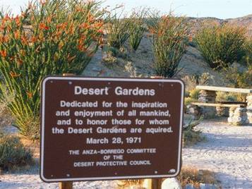
Desert Protective Council of 1954
This council, with its inception in 1954, is a group of caring individuals that pursue the same cause; to protect, appreciate, and enjoy nature's deserts. They claim to "speak" for the landscapes and the plants and animals that depend on the land that are threatened by exploitation, development, poaching, and other abuses. The council had hard won successes that have resulted in the preservation of wildlife habitats and natural resources of the four great deserts of the southwest. It is a non-profit organization that depends on membership to increase the power of their conservation activities. A major goal of this protection council is to permeate enthusiasm for the desert to a greater audience, ensuring a lasting constituency for desert conservation. Furthermore, the council offers a variety of opportunities for volunteers who can aid in the protection of deserts, including grants for Imperial County conservation and education projects, stewardship outings, action alerts, wilderness area monitoring, and more.
UNESCO Scientific Research Project
International Geological Correlations Programme (IGCP) Project 391
United States:
Dr. Farouk El-Baz
Center for Remote Sensing Boston University
Dr. Ted A. Maxwell
National Air and Space Museum
Smithsonian Institution
Egypt:
Dr. Ibrahim Hassan HimidaDesert Research Center
1 Mathaf El-Matarya Street
Matarya, Cairo, Egypt
The United Nations Educational, Scientific and Cultural Organization (UNESCO) is sponsoring this project on Sand Accumulation and groundwater in the Sahara Desert in the easter region, which is known to be the driest on earth. The research is conducted on the amount of rainfall. These scientists worked together and made this scientific research possible through observing the wind movement in the desert which is directed towards the south most of the year. The second is that the sand dune fields are composed of well rounded quartz grains. Therefore, it is more likely that the areas covered by dune sand were topographically low areas that received sediments from northward flowing rivers and streams in the geological past. A quote from the article:
"The eastern Sahara is the driest region on Earth, where the received solar radiation is capable of evaporating over 200-times the amount of rainfall. It is characterized by a vegetation-free expanse of sandstone in the south and a limestone plateau in the north, with numerous sand sheets and sand dunes in numerous patterns. All of the dune fields occur within or near topographic depressions. This fact must be explained in any theory regarding the origin of the sand and the evolution of dune forms in space and time. This hypothesis has a far reaching implication: because the sand was transported by paleo-rivers, the depositional basins would have received vast amounts of fresh water. Most of that water would seep, through primary and secondary porosity, into the rocks beneath the sands. Thus, areas that encompass large sand dune accumulations in this part of the Sahara may host vast ground water resources. In addition to the comparatively well-known horizontal aquifers in porous sediments, it is believed that more of that water exists in fracture zone aquifers, which are extensive, nearly vertical zones in the rock that may contain large amounts of yet untapped resources."
Participating Scientists:
W.M. Edmonds (Head, Hydrogeochemistry Department, British Geological Survey, London, England): Mr. Edmonds is responsible for the collection of data on groundwater resources in the Middle East within the British Geological Survey.
Farouk El-Baz (Director, Center for Remote Sensing, Boston University, 725 Commonwealth Avenue, Boston, MA 02215, USA): Co-Principal Investigator with 30 years experience in the study of satellite images or arid lands, particularly for the location of groundwater resources. He will be responsible for the overall management of the project, assignment of tasks to participants, publication of Workshop proceedings, and dissemination of the results.
Salah Mohamed El-Hinnawy (Senior geologist, Egyptian Geological Survey and Mining Authority, 3 Salem Street, Abbasia, Cairo, Egypt): Dr. El-Hinnaway is an expert on landform development and geoarchaeology of the Western Desert of Egypt. He will be responsible for surveying the research results of the Egyptian Geological Survey as they may relate to the Workshop topic.
Elyagoubri, El-Bahloul (Director of Higher Education and Scientific Research, ALESCO, P.O. Box 1120, Tunis, Tunisia): Dr. Elyagoubi is the author of a book and numerous papers on the geology of Libya. He will participate in the discussion of groundwater resources, and will also identify sources of collaborative research by regional agencies.
Embabi, N.S. (Professor of Geography, Department of Geography, Faculty of Arts, Ain Shams University, Abbasiam Cairo, Egypt): Dr. Embabi is a senior scientist who studied dune accumulations in the eastern Sahara and the southern Arabian Peninsula. He contributes significantly to the understanding of dune forms and their distributions in the dune fields and sand seas.
Hassan, M.H.A. (Executive Director, Third World Academy of Sciences, International Centre for Theoretical Physics, Trieste 34100, Italy): Dr. Hassan is a mathematician who has applied modeling to arid land processes. He has co-edited several books on issues of desert development and will be responsible for the applications of mathematical modeling to the Workshop topic.
Haynes Jr., V.C. (Professor of Quaternary Geology, Department of Anthropology, University of Arizona, Tucson, Arizona 85721): Dr. Haynes has over 20 years of experience in the study of the late Quaternary in the Western Desert of Egypt and the adjacent areas of northwestern Sudan. He will review research results in this field as they may relate to groundwater accumulation.
Hefny, Kamal (Senior Advisor, Research Institute for Groundwater, Ministry of Public Works and Water Resources, El-Qanatir El-Khairiya, Egypt): Dr. Hefny has previously managed the production and publication of the “Hydrological Map of Egypt”. He will discuss the map and its updates for the benefit of other participants.
Himida, Ibrahim (Deputy Director, Desert Research Center, 1 Mathaf El-Matariya Street, El-Matariya, Cairo, Egypt): Dr. Himida will serve as Co-Organizer of the Workshop and handle all local arrangements. He is a renowned hydrogeologist with over 30 years of experience in solving groundwater problems in Egypt’s deserts.
Khair, M.S. (Undersecretary of Irrigation, Ministry of Irrigation, Khartoum, Sudan): Prof. Khair is most knowledgeable about water resources in the Sudan and is responsible for the location of groundwater for desert reclamation projects.
Kusky, Timothy (Assistant Professor, Geology Department, Boston University, 675 Commonwealth Avenue, Boston, MA 02215, USA): Dr. Kusky is a junior faculty member who specializes in structural geology, and particularly, the influences of tectonic trends on groundwater resources in fracture zone aquifers.
Marchant, David (Post-doctoral Fellow, Institute of Quaternary Studies, University of Maine, 5711 Boardman Hall, Orono, Maine 04469, USA): Dr. Marchant is an expert on landform development in arid environments and will assist in the evaluation of erosional landforms as they may relate to surface water flow.
Mainguet, Monique (Director, Laboratoire due Geographie Zonale, U.F.R des Lettres et Sciences Humaines, Universite de Reims, 57 rue Pierre Tattinger, 51100 Reims, France): Dr. Mainguet is a renowned expert on the sand seas of the Sahara. She has acquired her knowledge through both study of satellite images and detailed field investigations throughout the Sahara. She will lead the discussion on dune concentrations, and particularly, the effects of the wind regime.
Maxwell, Ted A. (Senior Adviser to the Director, National Air and Space Museum, Smithsonian Institution, Washington, D.C. 20560, USA): Co-Principal Investigator who has 15 years experience in the study of desert landforms in Egypt and Sudan. He will be responsible for the preparations of the Landsat images and the publication of Workshop results as well as the planning of collaborative research projects.
Morency Jr., R. (Post-doctoral Fellor, Center for Remote Sensing, Boston University, 725 Commonwealth Avenue, Boston, MA 02215, USA): Dr. Morency obtained his Ph.D. in 1995 on the hydrogeology of the northeastern Sinai, Egypt. His work on the modeling of groundwater accumulation will be of value. He also assisted in the preparation of the Workshop proceedings.
Robinson, Cordula (Research Assistant, Center for Remote Sensing, Boston University, 725 Commonwealth Avenue, Boston, MA 02215, USA): Dr. Robinson is a radar expert and her work will be of assistance in the evaluation of features revealed by the shuttle’s Spaceborne Image Radar (SIR-C) and the Canadian Radarsat images of the eastern Sahara.
Salem, Omar (President, General Directorate of Water Resources, Tripoli, Libya): Dr. Salem is responsible for hydrogeological investigation in Libya. He is well versed in the history of the development of the Great Man-Made River project and the groundwater basins in Libya.
Saleh, Abdin (Deputy Vice-Chancellor, University of Khartoum, Sudan): Prof. Saleh is a leading expert on the management of water resources. He serves as a member of the Advisory Board of UNESCO on the Great Man-Made River project.
Singroy, V.H. (Senior Research Scientist, Canada Centre for Remote Sensing, 588 Booth Street, Ottawa, Ontario, K1A OE4, Canada): Dr. Singroy is program scientist of Radarsat and is well versed in the potential contributions of radar images to groundwater exploration in Middle Eastern countries.
Yehia, Adel (Professor of Geology, Faculty of Sciences, Ain Shams University, Abbassia, Cairo, Egypt): Dr. Yehia is an expert in remote sensing and the application of satellite image interpretations to resource exploration, particularly in the Western Desert of Egypt.
Zaghloul, Z.M. (Professor of Geology, Faculty of Science, Mansoura University, Mansoura, Egypt): Dr. Zaghoul’s research has concentrated on geological processes during the Quaternary. He has previously organized and chaired two conferences on the Quaternary in Egypt.
